Log in
All resources
Create a design
3,539 Free Artworks of Maps Of Amsterdam
maps in the stadsarchief amsterdam
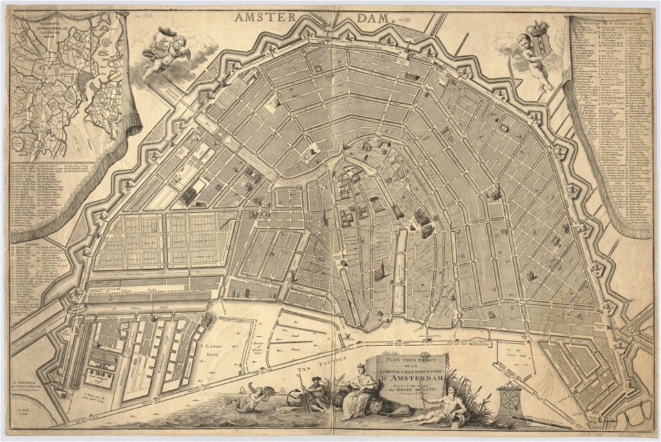
hendrik de leth
new amsterdam
adriaen van der donck
maps made in the 17th century
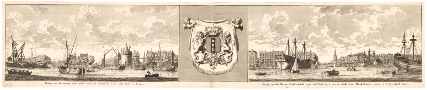
dutch 17th-century prints in the rijksmuseum amsterdam
maps in the amsterdam museum
old maps of new york (state)
maps of the hudson river
maps of nieuw nederland
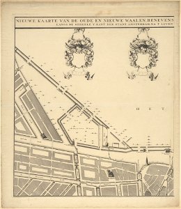
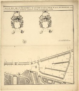
maps in the stadsarchief amsterdam
hendrik de leth
maps in the stadsarchief amsterdam
hendrik de leth
maps in the stadsarchief amsterdam
hendrik de leth
maps in the stadsarchief amsterdam
hendrik de leth
maps in the stadsarchief amsterdam
hendrik de leth
maps in the stadsarchief amsterdam
hendrik de leth
maps in the stadsarchief amsterdam
hendrik de leth
maps in the stadsarchief amsterdam
hendrik de leth
maps in the stadsarchief amsterdam
hendrik de leth
old maps of amsterdam
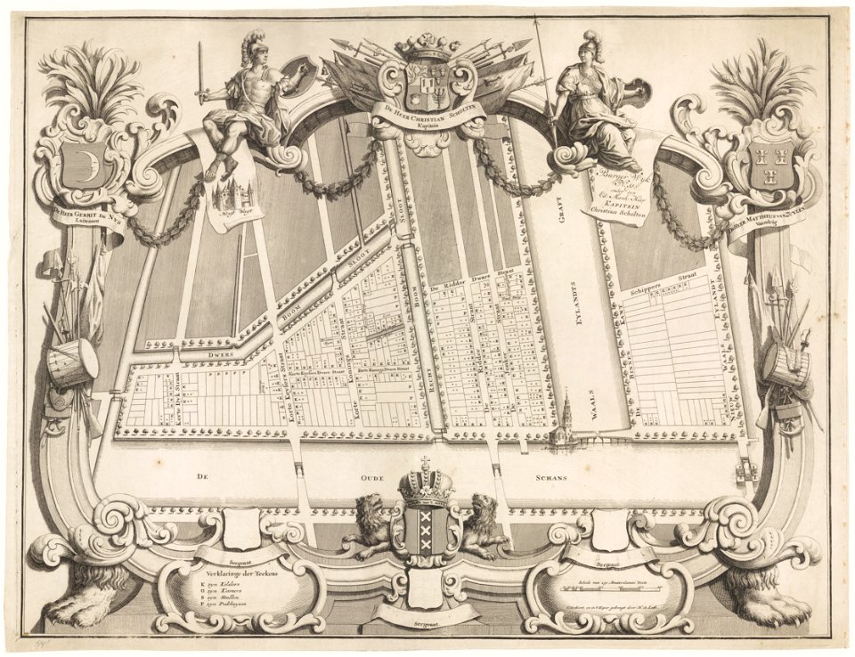
maps with cartouches
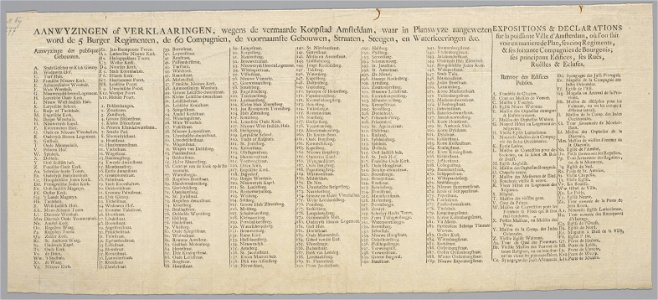
maps in the stadsarchief amsterdam
daniel stoopendaal
maps in the stadsarchief amsterdam
daniel stoopendaal
maps in the stadsarchief amsterdam
daniel stoopendaal
maps in the stadsarchief amsterdam
daniel stoopendaal
maps in the stadsarchief amsterdam
daniel stoopendaal
topographical paintings in the amsterdam museum
paintings of amsterdam
maps in the rijksmuseum amsterdam
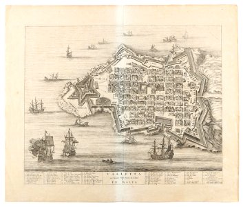
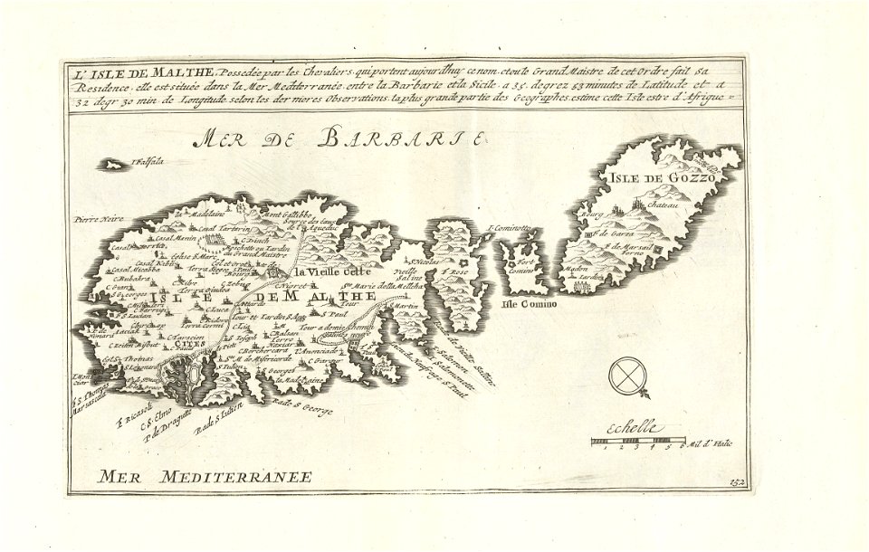
old maps of valletta
dutch 17th-century prints in the rijksmuseum amsterdam
old maps of gibraltar
old maps of amsterdam
frederick de wit
dutch 18th-century prints in the rijksmuseum amsterdam
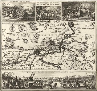
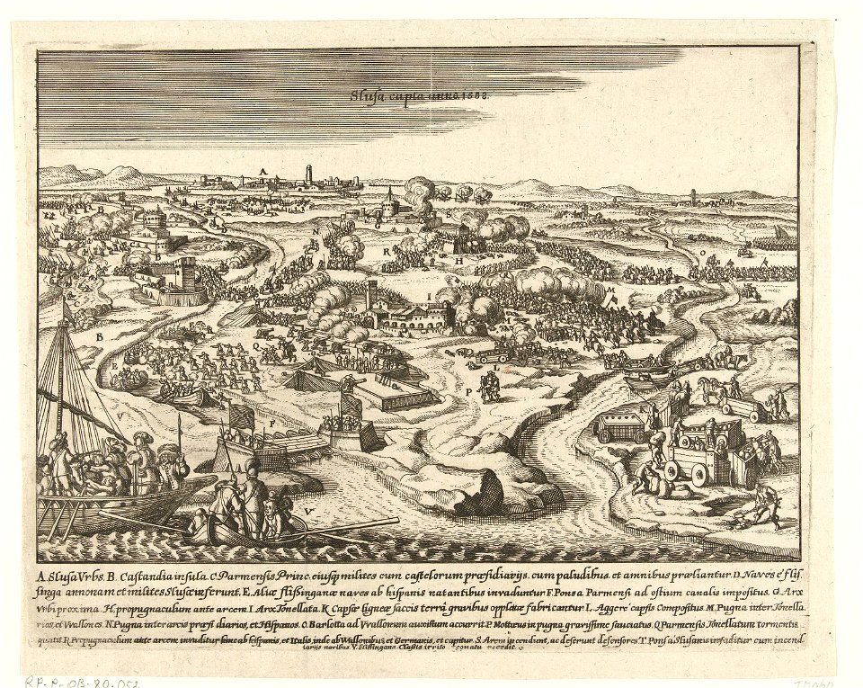
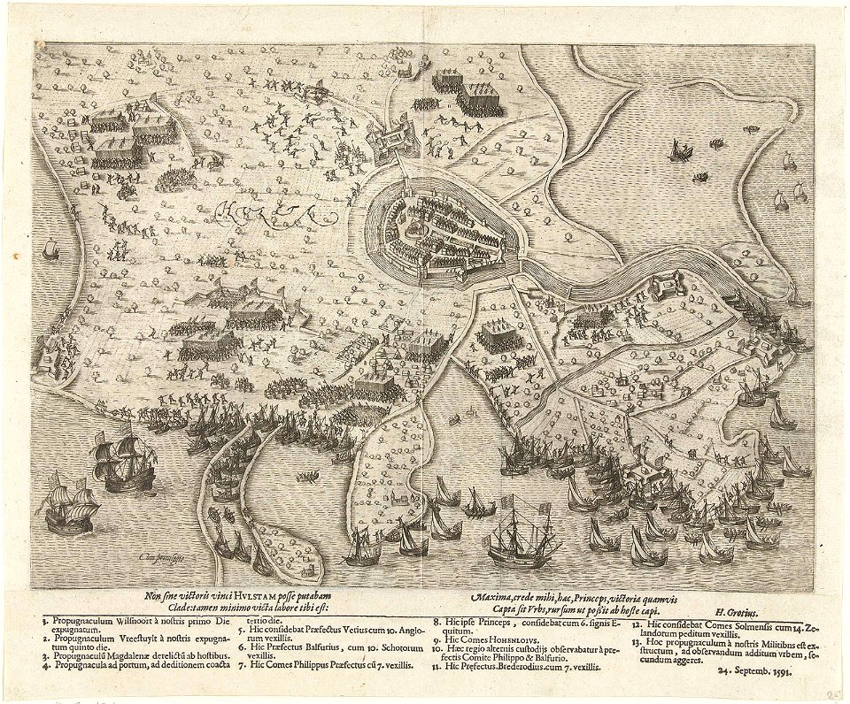
battles of the eighty years' war
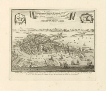
old maps of venice
carolus allard
maps in the stadsarchief amsterdam
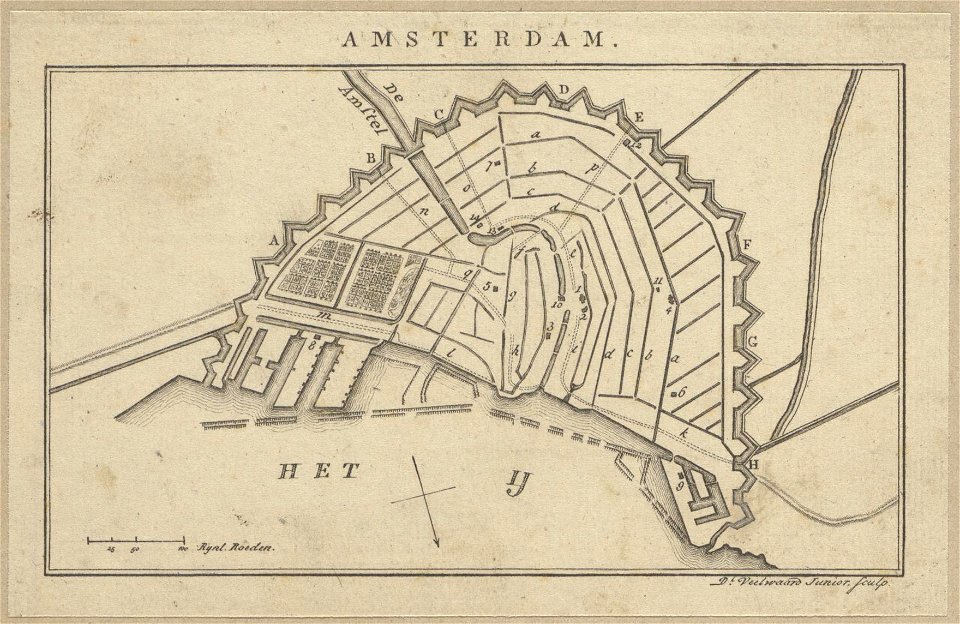
daniël veelwaard (i)
maps in the stadsarchief amsterdam
daniël veelwaard (i)
maps in the stadsarchief amsterdam
daniël veelwaard (i)
maps in the stadsarchief amsterdam
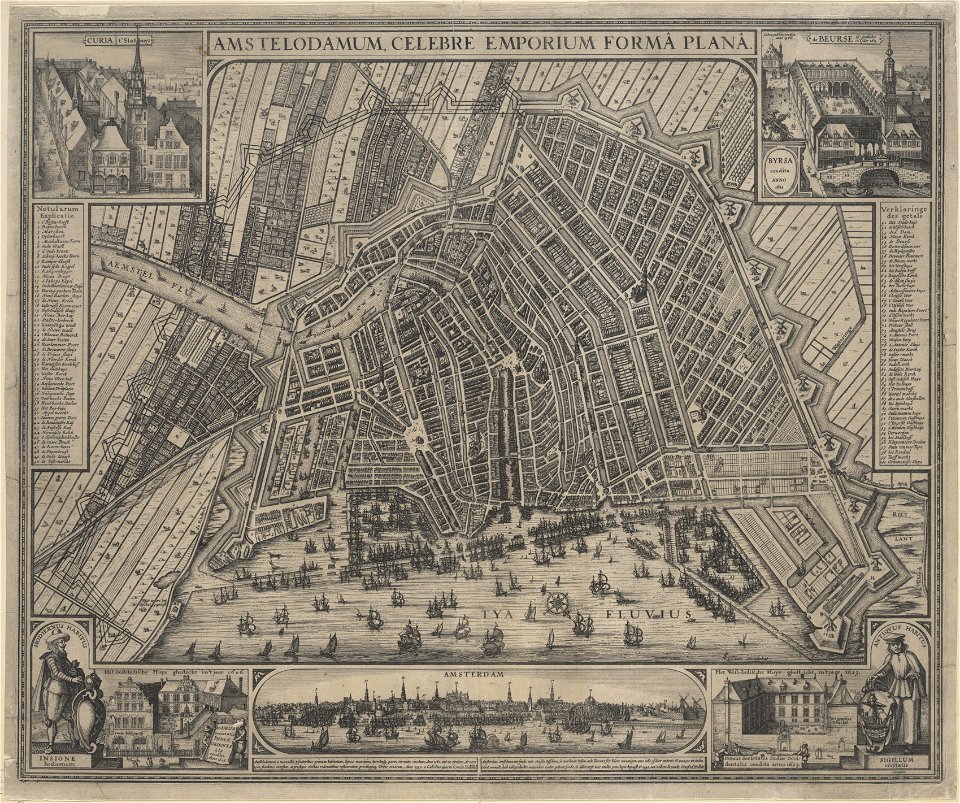
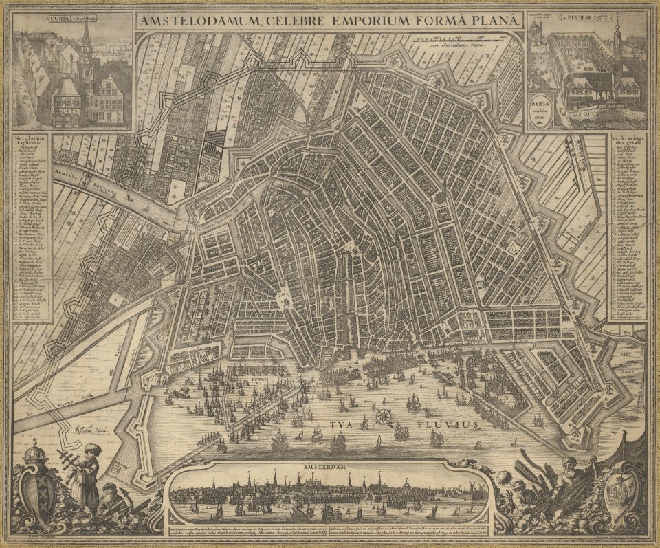
claes jansz. visscher (ii)
maps in the stadsarchief amsterdam
claes jansz. visscher (ii)
maps in the stadsarchief amsterdam
daniël veelwaard (i)
maps in the stadsarchief amsterdam
daniël veelwaard (i)
maps in the stadsarchief amsterdam
claes jansz. visscher (ii)
maps in the stadsarchief amsterdam
daniël veelwaard (i)
maps in the stadsarchief amsterdam
daniël veelwaard (i)
maps in the stadsarchief amsterdam
hendrik de leth
maps in the stadsarchief amsterdam
hendrik de leth
maps in the stadsarchief amsterdam
claes jansz. visscher (ii)
koninklijk nederlands aardrijkskundig genootschap
intaglio (printmaking)
maps in the stadsarchief amsterdam
claes jansz. visscher (ii)
published by frans buffa & zonen
maps in the stadsarchief amsterdam
maps in the stadsarchief amsterdam
claes jansz. visscher (ii)
maps in the stadsarchief amsterdam
claes jansz. visscher (ii)
maps in the stadsarchief amsterdam
hendrik de leth
maps in the stadsarchief amsterdam
hendrik de leth
maps in the stadsarchief amsterdam
hendrik de leth
maps in the stadsarchief amsterdam
hendrik de leth
dutch 17th-century prints in the rijksmuseum amsterdam
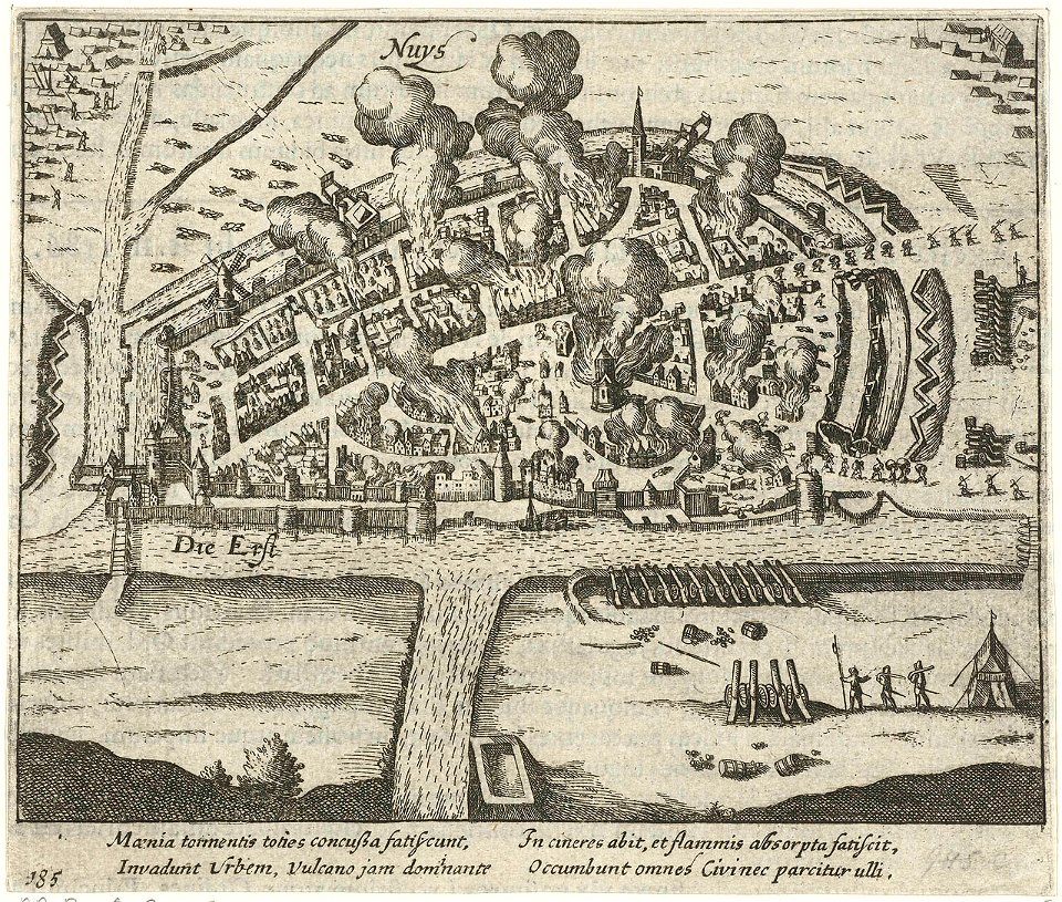
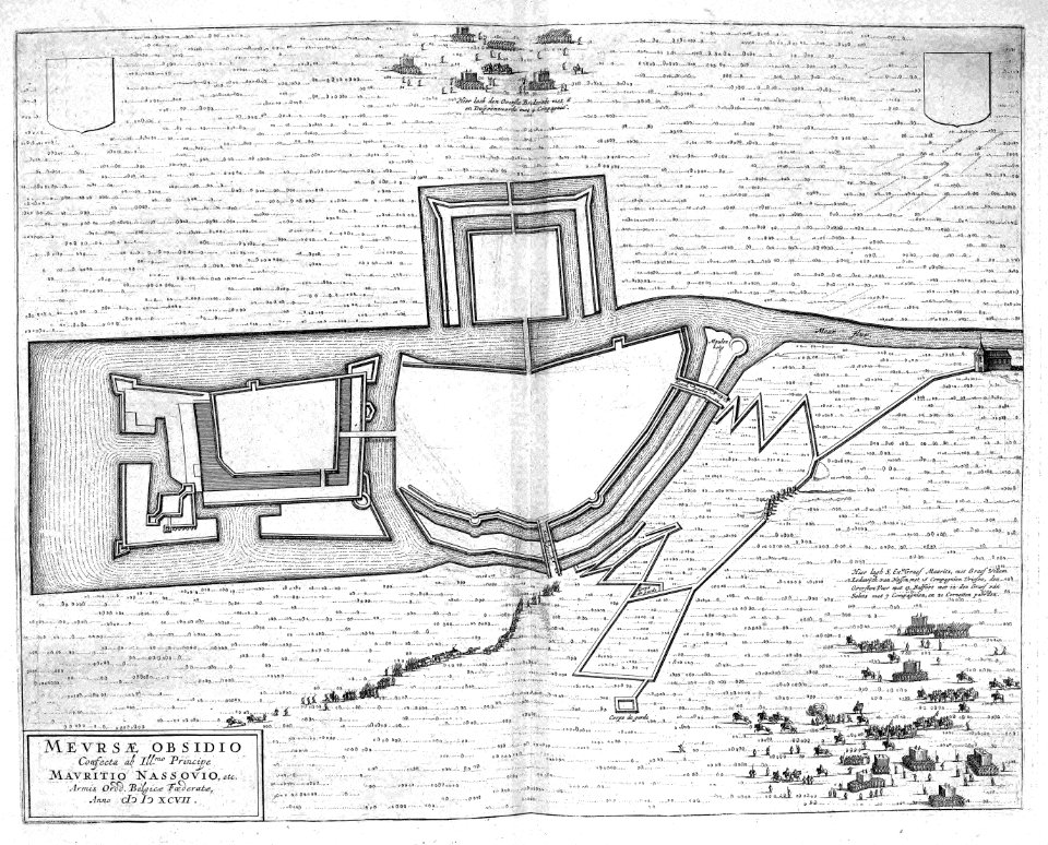
history of neuss
old maps of valletta
joan blaeu
maps in the stadsarchief amsterdam
hendrik de leth
dutch 17th-century prints in the rijksmuseum amsterdam
old maps of gelderland
adriaen van der donck
harvard university
flemish 16th-century prints in the rijksmuseum amsterdam
1599
netherlands
the hague
maps in the amsterdam museum
pages using map template with incorrect parameter
nieuwe hollandse scheeps-bouw (1695)
maps in the rijksmuseum amsterdam
old maps of malta
maps of zuid-kennemerland
hendrik de leth
maps in the amsterdam museum
daniel tavernier
maps of zuid-kennemerland
hendrik de leth
maps in the amsterdam museum
daniel tavernier
maps in the amsterdam museum
daniel tavernier
1726
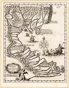
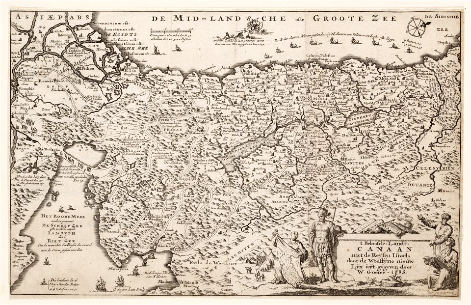
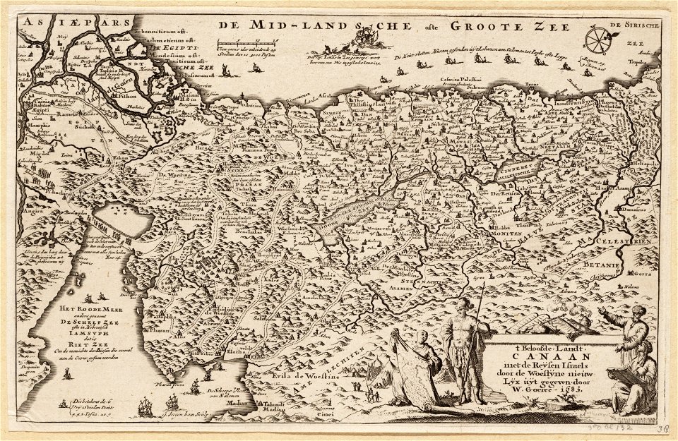
asie
flemish 17th-century prints in the rijksmuseum amsterdam
frans hogenberg
maps in the amsterdam museum
maps in the amsterdam museum
maps in the amsterdam museum
french prints in the rijksmuseum amsterdam
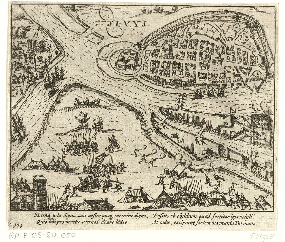
sluis
prints of cartouches in the rijksmuseum amsterdam
old maps of valletta
atlantis magni tomus secundus (biblioteca comunale di trento)
maps made in the 17th century
maps in the amsterdam museum
dutch 17th-century prints in the rijksmuseum amsterdam
maps in the rijksmuseum amsterdam
dutch 17th-century prints in the rijksmuseum amsterdam
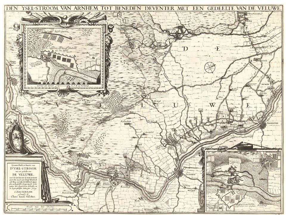
ijssel
dutch 17th-century prints in the rijksmuseum amsterdam
jan janssonius
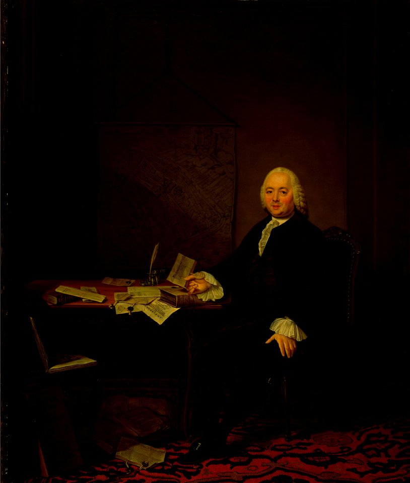
portrait paintings of sitting men with left hand resting on lap
maps in portrait paintings
charts and maps of the royal museums greenwich
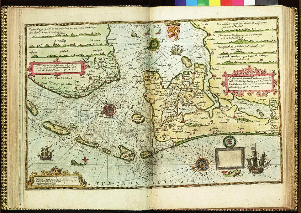
lucas janszoon waghenaer
dutch 17th-century prints in the rijksmuseum amsterdam
zeeland in art
archduke of austria
albert vii
maps of the west-indische compagnie
1800 maps of the united states
17th-century oil on canvas paintings in the netherlands
male fur clothing in art
maps in the library of congress
adriaen van der donck
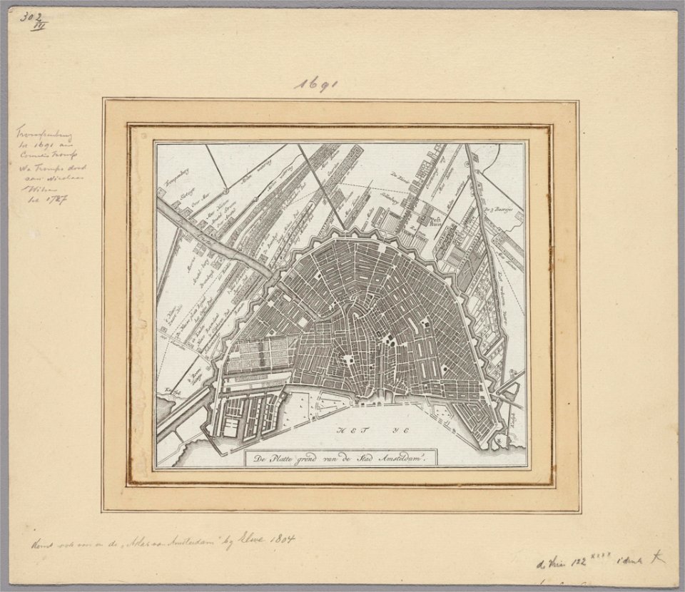
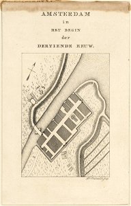
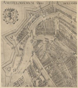
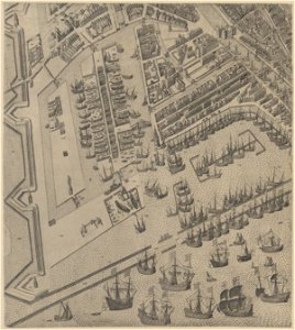
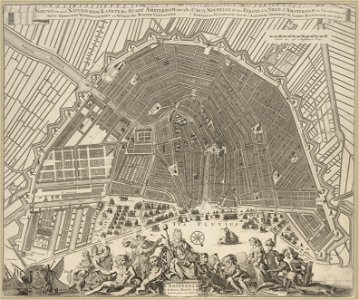
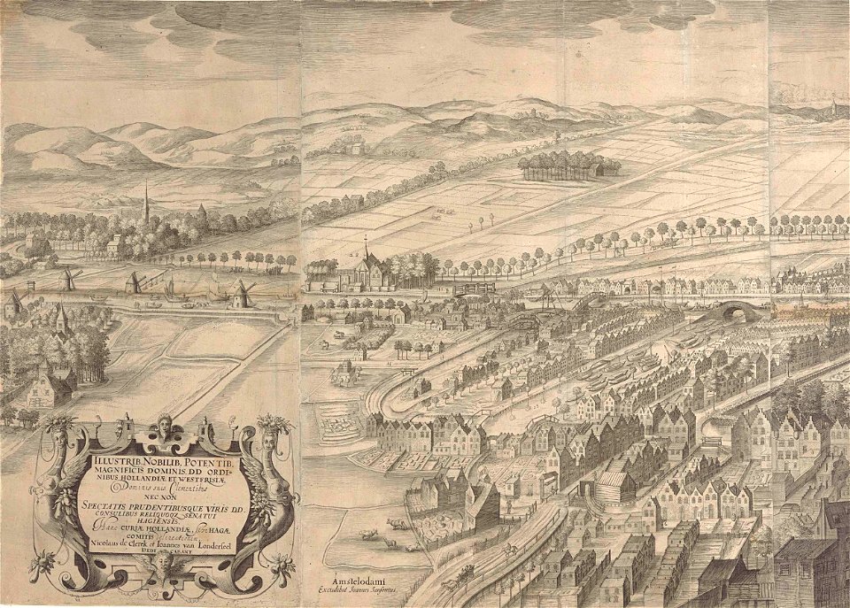
17th-century maps of amsterdam
amsterdam in the 1640s
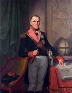
portrait paintings of men holding baton
19th-century cabinet portraits
1640s maps of the world
1660s maps of the world
maps in the library of congress
adriaen van der donck
paintings by johannes vinckboons in the rijksmuseum amsterdam
old maps of ayutthaya
lawrence h. slaughter collection of english maps, charts, globes, books and atlases
maps of nieuw nederland
maps in the library of congress
adriaen van der donck
maps from university of amsterdam special collections
atlas der neederlanden
maps in the library of congress
adriaen van der donck
maps in the library of congress
adriaen van der donck
details of old maps of amsterdam
maps of dam square
maps in the library of congress
adriaen van der donck
old maps of svalbard
old maps of iceland
maps from university of amsterdam special collections
atlas der neederlanden
details of old maps of amsterdam
map of amsterdam, 1544
maps from university of amsterdam special collections
atlas der neederlanden
atlas van der hagen (volume 4)
atlas van der hagen
maps of avesnes-sur-helpe by braun & hogenberg
frederick de wit
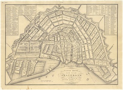
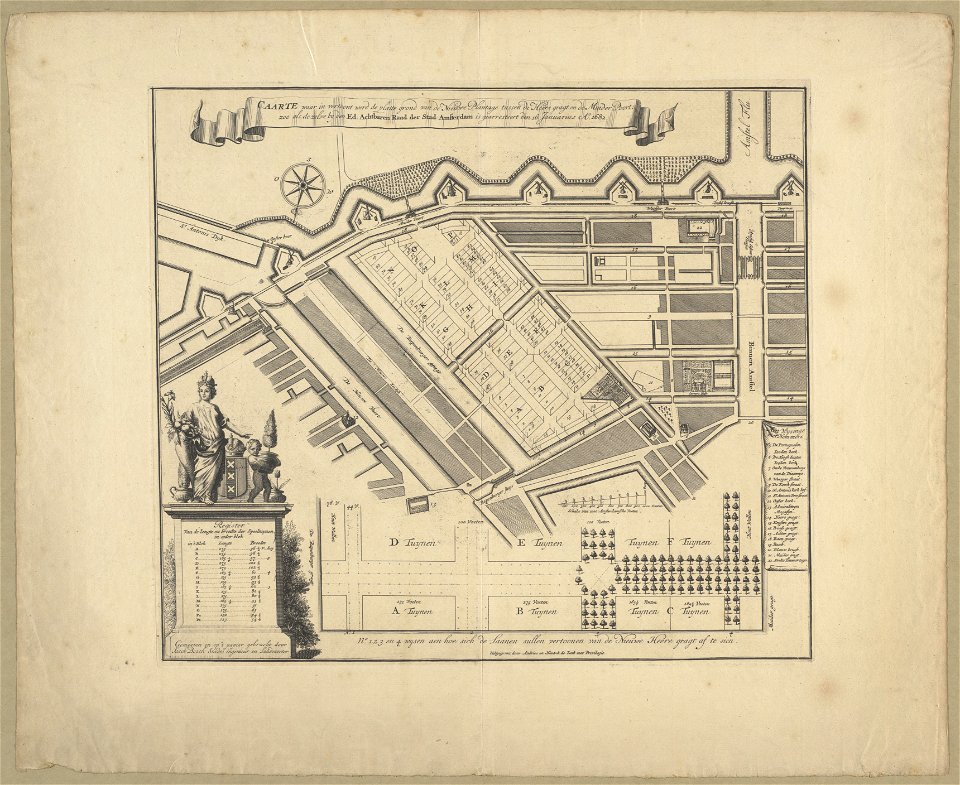
dienst der publieke werken
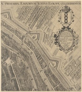
old maps of amsterdam
maps by willem and johannes blaeu
pantanal
gemeente atlas van nederland - north holland
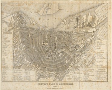
19th-century maps of amsterdam
maps from university of amsterdam special collections
atlas der neederlanden
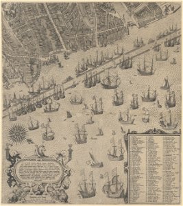
1673 in new york city
24 august
201 - 300 of 3,539
Next page
/ 36


![Map of the Islands of Japan and the peninsula of Korea: with the coasts of China from Peking to Canton / by N. Bellin; J. v. Schley direx, Jakob van der Schley, [1773]](https://cdn.creazilla.com/illustrations/10000188400/map-of-the-islands-of-japan-and-the-peninsula-of-korea-with-the-coasts-of-china-from-peking-to-canton-by-n-bellin-j-v-schley-direx-jakob-van-der-schley-1773-md.jpg)


